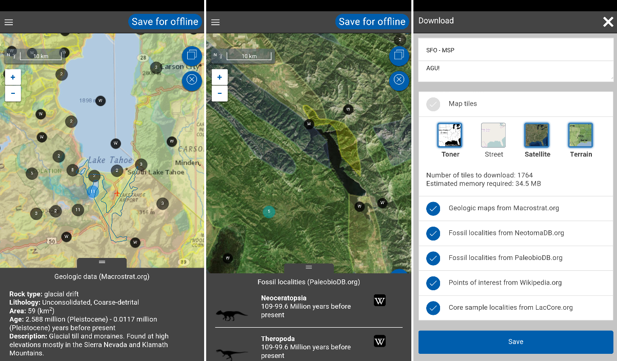
Flyover Country is a free app which can tell you more about the world along the path of your flight, hike or road trip.
This doesn't mean restaurants, or hotels with live booking. Flyover Country is a National Science Foundation app from the University of Minnesota, and its focus is geoscience: geologic data, maps, fossil information, georeferenced Wikipedia articles, and more.
The app works by analyzing your flight path and caching relevant data and points of interest. This means you can use it offline, without having to rely on in-flight wifi, and also keeps storage requirements to a minimum.
This focused approach makes for a simpler display, too, as you're not bombarded with hundreds of irrelevant markers. The map only displays points you might be able to see from your airplane window seat, while also trying to use GPS to track your position right now. (The developer warns that in-flight GPS needs you to be in a window seat, and still might not be reliable for all devices and situations.)
What's New
What's New in Version 0.4.3
-Now featuring information about clouds!
-Your flights over the ocean will now be enhanced by information about ocean science
-Bug fixes - thanks for the reports!
Verdict:
A neat idea, and an easy way to find out more about the route of your next trip.


Your Comments & Opinion
Find a parking space in 1,000+ cities
An iOS app to help you book flights, plan itineraries and much more
Order a black-cab driver via your phone
Manage your navigation through public transport using TripGo
Find the easiest way across your city
A straightforward currency converter that will save you time and money
Maps on the go without biting into your data usage
Find the cheapest flights to just about anywhere with this comprehensive search engine
Real-time 3D astronomy visualisation
Explore the world in three dimensions
Explore the world in three dimensions
An excellent paint program for children aged 3 to 12.
An excellent paint program for children aged 3 to 12.