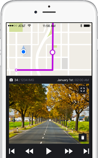
OpenStreetCam is a free and open platform which aims to improve OpenStreetMap with Google Street View-like street level imagery.
The idea is that you set up your app to automatically record snapshots while driving. The results are uploaded, processed to "detect salient features from the uploaded images such as signs, lanes and road curvature", then made available to other OpenStreetMap users.
Checking out the OpenStreetView map shows what's been done so far. Areas with coverage are highlighted in purple, you can zoom right down to road level, click a particular location, then repeatedly click Play to move step-by-step through that user's track.
What's New in Version 1.4.7
OpenStreetView is now OpenStreetCam!
Verdict:
OpenStreetCam's coverage is going to be patchy for a while - maybe forever - but these apps will help improve the results in your local area. And if it takes off, the service should deliver far more up-to-date and reliable images than Google Street View.


Your Comments & Opinion
Manipulate maps, GPS data and more with this comprehensive tool
Help build this alternative to Google Street View
Maps on the go without biting into your data usage
A gorgeous map creation tool for Mac users
The latest stable Chrome is a rather minor update
The latest stable Chrome is a rather minor update
The latest stable Chrome is a rather minor update
Check out the next version of Firefox before it's release
Check out the next version of Firefox before it's released