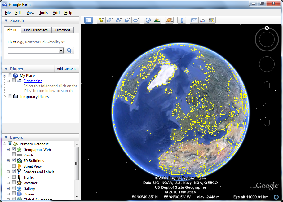
Google Earth enables you to travel the world from the comfort of your desktop, exploring stunning satellite imagery in stunning 3D. The fluid interface makes it easy to jump from country to country and zoom right in to street level. Certain key cities around the world benefit from 3D tours which can be used to take a virtual tour of key landmarks and get a feeling of the lay of the land.
You can also search for local businesses and places of interest, and the pinpointing tools mean that it is possible to bookmark locations on the map and share them with others. This feature can also be used to create virtual sightseeing tours - perhaps to show off the route you have taken on your travels.
While the program is immense fun, it can also be put to more serious uses. A range of different maps can be displayed, including historical maps which can show how country boundaries have changed over the years. Google Earth can also be used as route planner and to find out valuable information about towns, cities and country you plan to visit. Additional components are available that can be used to take virtual tour of the sky, moon and sun and the way in which users are invited to generate their own content to add to maps means that there is always something new to find.
Verdict:
An educational tool which is also a great deal of fun, Google Earth bring geography to life.


Your Comments & Opinion
Explore the world in three dimensions
Download Google maps for offline viewing
Google Earth's extended version is now free
Free satnav software for your iPhone or iPad
Find your way around central London by bus
Track your cycling workouts with your iPhone
Protect the Earth from attack in this fast paced space shooter
Real-time 3D astronomy visualisation
Explore the world in three dimensions
An excellent paint program for children aged 3 to 12.
An excellent paint program for children aged 3 to 12.
An excellent paint program for children aged 3 to 12.